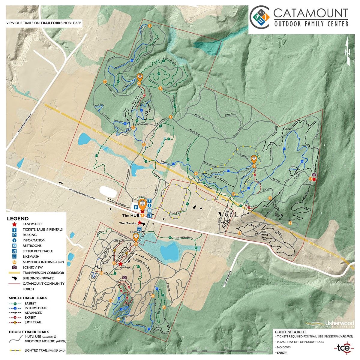
TRAIL MAPS & CONDITIONS

April 27th – May 4th

Trail Soft Opening/ Use Caution: The entire south side was opened Saturday. Sandmans, Cliffs, Rock Spine, Bear Run/Slalom can be accessed from the Governor Chittenden Road trail head.  The venue field and main access points remain wet. Trails are still fairly saturated, so no rentals will be available. Skinny tires please refrain from trying Sandmans until things dry out more. 

Reminder: If you are leaving a track, please turn back. Traveling on soft trails can damage the trail base during this sensitive time of year.

April has brought a mix of snow, rain and sunshine to Catamount; While warmer temperatures may make it feel like adventure season is here, the trails are not yet ready for normal use. Please help protect the trail system by avoiding travel on wet and muddy trails. Riding or walking on soft surfaces can cause lasting damage and lead to extended closures. We’ll continue to provide updates as conditions change.

Thank you for your patience and understanding. Eager to help get trails back in great shape? Check out our spring trail work series!

Allowed usage:

  • Folks can park in our main lot and walk Governor Chittenden Road or other, more durable surfaces as outlined on trail forks below.
  • Night Loop lights are off for the season
  • Rentals are closed until trails dry out

Remember: If you are leaving a track, please turn back. When snow is soft/thin, the ground underneath is also soft. Please travel carefully to avoid damaging the trail base during this sensitive time of year.

Remember to member up! Membership comes with many benefits, including early camp access.

Support our nonprofit’s year round stewardship.

Catamount Outdoor Family Center mountain biking trails

Please review our Spring Trail Mantras:

For the sake of all trail users please be patient during freeze thaw cycles. Thank you for helping us steward these trails.

If you are leaving a muddy track, please turn back.

Trail Mantras

Quick Links

TRAIL MAPS

Catamount Outdoor Family Center is our area’s centrally located and most extensive professionally maintained multi-use trail network. The trails offer non-motorized, recreational opportunities for people of all ages and ability levels.

OVERALL MAP
Catamount Trail Map 2021

Please note that the trail difficulty levels indicated on TrailForks, may differ from our official trail map. Please use the COFC map for trail difficulty.

Subscribe to the Catamount Newsletter!

Join our mailing list and be the first to know about upcoming events and conditions to help plan your next adventure at Catamount.